

Oxford Milestones: Magdalen College (Chancellor’s Milestone)
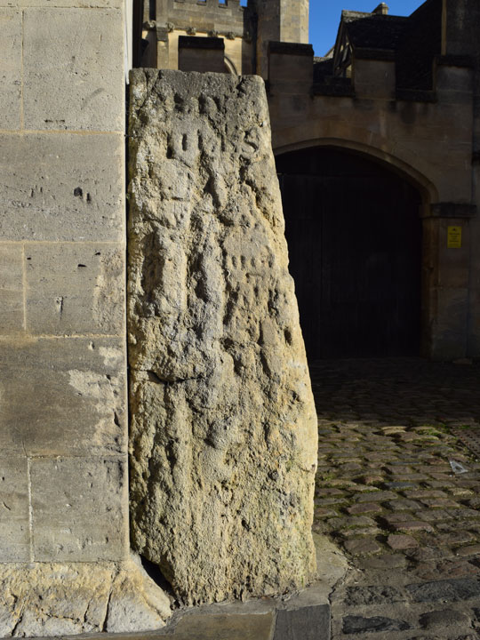
L I V
M I L E S
[to
London]
[54 miles to London:
marking the exit from the City of Oxford]
The rest is illegible, but the 1876 map
of Oxford marks this stone as
a milestone (M.S.) and adds
LONDON 54 WOODSTOCK 8½
This is known as The Chancellor's milestone, and is presumably so named because its position on the east corner of Magdalen College, Oxford, near Magdalen Bridge marked the end of the jurisdiction of the University, as well as the city boundary before St Clement's was taken into Oxford in 1835
Grade II listed:
List Entry No 1184726
GoogleMaps shows that the distance between the milestone at the top of Headington Hill and this one is exactly one mile, as is the distance in the other direction to the milestone outside 12 Woodstock Road
This stone also marked the end of the turnpike road from Henley to Oxford, part of an alternative route from London. An Act of 1841 (Cap. C.) is entitled: “An Act for Repairing The Roads Leading from Henley-Upon-Thames to Culham Bridge, and to The Chancellor's Milestone near Magdalen Bridge, in The County of Oxford”. The distance between the Rose Hill milestone and this one is exactly two miles, so an intervening milestone on the Iffley Road must have been lost.