

The Little Gate in the South Wall, and St Ebbe's
The Little Gate (or Little South Gate) was at the exact point where St Ebbe’s Street meets Littlegate Street, and explains why what is now a continuous road suddenly has a change of name here. It was earlier known as Water Gate, and had a small arched gateway for pedestrians and a larger one for carts. The pedestrian arch survived until 1798.
 The site of the Little Gate
 Close-up of the plaque visible in the distance in the above picture
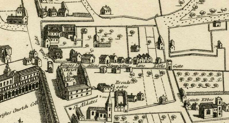
The above extract from Agas's map of 1578, looking south with St Ebbe's Church on the right, shows the Little Gate spanning St Ebbe's Street in line with the city wall on the north side of the present Brewer Street (here described as “Kinges St. alias Slaying Lane”).
The engraving below by Joseph Skelton (Historic England HT00114) shows the ruins of the old Little Gate:
The south wall to the west of Littlegate Street
The south wall then ran through St Ebbe's parish. It reappears on the other side of the road behind Nos. 8–10 Turn again Lane. Formerly Charles Street, this road returned to its old name in 1972. This piece of wall is on private property and cannot be viewed.

The wall then moves in a north-westerly direction until it reaches the junction of Castle Street, Paradise Street, and Norfolk Street, which was the site of the old West Gate.
The above photograph was taken by Henry Taunt in 1912 in the back garden of 7 Princes Street, St Ebbe's (Historic England HT13881). It shows the city wall joining that of Greyfriars. (Princes Street, now demolished, ran from 1 Paradise Square to Penson's Gardens.
Next: West Gate and St Peter-le-Bailey Church
