

“Circuit of Franchises” in 1773
Anthony Wood, The Antient and Present State of the City of Oxford…. The whole chiefly collected by Mr Anthony à Wood; with additions by the rev. Sir J. Peshall, Bart (1773) can be downloaded here. It describes the city boundary in 1773 as follows (p. 371):
Their [the Mayor and Corporation of Oxford's] District, or Circuit of Franchises, extends from Magdalen Bridge to Milham, Great Marten River, thence cross Christ-Church Mede above the Ditch to the Walk; to the Wharf down to Free‑Water Stone, and back again, through Bell-Founder's Arch, over the Meads and cross Hog Acre Ditch to Hinxey Ferry; to Botley, and up Seacouth [Seacourt], hard by Binsey Church, and up to Godstow, cross the Fields down the Isle of Rhe [spelt Ree on the map]; then take Boats to Magdalen Bridge, and Home.
The above description is followed by this map of the route (with North to the left):
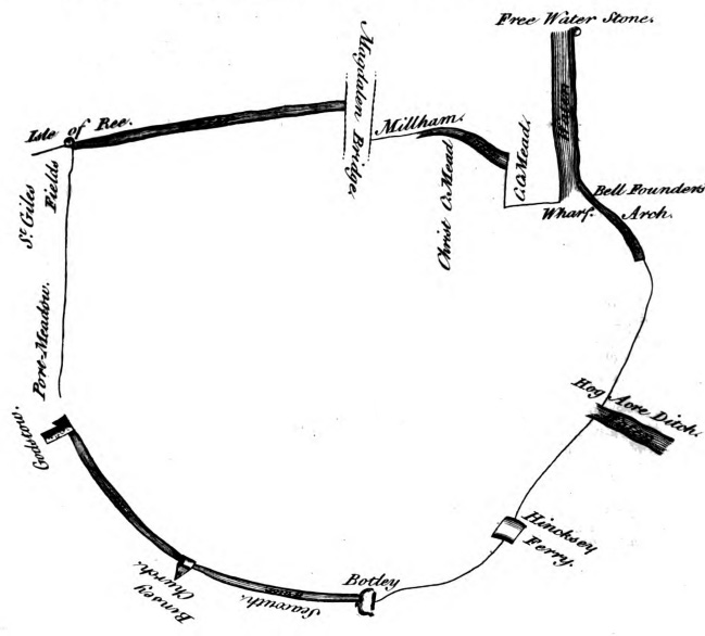
In 1773 the city boundary stretched northwards and westwards as far as Godstow, Seacourt, and Binsey, but did not yet include Summertown. On the east side it stopped at the River Cherwell, as even St Clement's was still outside the city.